Updated November 18, 2026. Indicative score. Weights: entertainment 11.73% (destinations and venues, rings up to 100 km); bars 3.73%; safety 15% with a penalty; water at country level; land price per m² = official source (ITBI, Terracap, registries, valuations) or listings with a caveat · coverage 100%
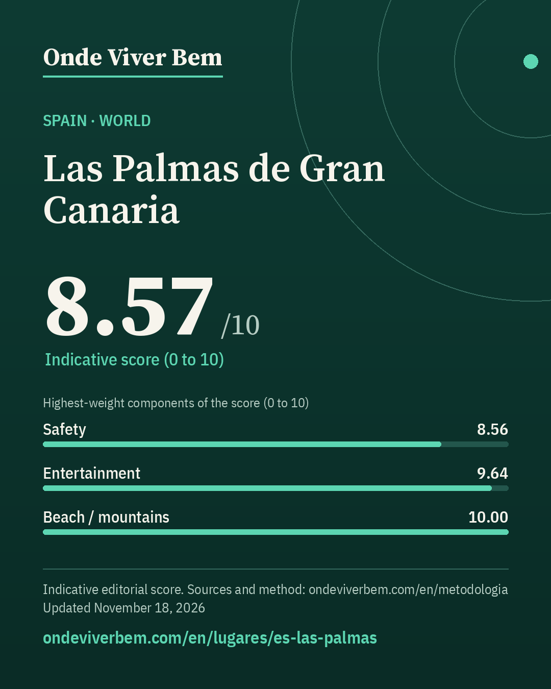
Las Palmas de Gran Canaria has an indicative score of 8.57/10 in the World ranking of Onde Viver Bem, updated November 18, 2026. The strongest published variables are Mild climate (10.00), Beach / mountains (10.00) and Entertainment (9.64); the weakest are Water (6.77), Bars (6.78) and Restaurants (7.70). The scores are indicative. Cost of living is not part of the score. The published land price per m² is US$ 448/m²; that price is not part of the score.
safety: feeling of safety at national level only (Gallup); safety: few homicides per year in the city (2 in 2023, 0 in 2024), and the rate swings from year to year; airport: military airfield without scheduled commercial flights does not count (LPA)
Land price per m²
US$ 448/m² (EUR 400)
official (urban-land transactions recorded at the registry) · source
Collected November 11, 2026 · exchange rate EUR 0.89342 per US$ (Frankfurter API (ECB reference rates), 2026-11-09)
Note: Official MIVAU index for municipalities with more than 50,000 inhabitants in the province of Las Palmas, average of the last 4 quarters (€ 409.44 / 319.56 / 400.23 / 470.43); there is no figure for the municipality alone.
Score breakdown
Each criterion's score, its weight in the total and the raw figure, linked to its source.
raw: 0.18 per 100k pop. · 40% violent deaths (log 30→0, 0.5→10 per 100k) + 30% city robbery ÷ country average (log 5×→0, 0.5×→10) + 30% share who feel safe at night (lin 30%→0, 95%→10); any part without data: weights renormalized
Composite safety: violent deaths 0.2 per 100k → 10.0 (weight 40%) · robbery 0.92× the country average (municipality 35016 Palmas de Gran Canaria (Las), 2024) → 7.3 (weight 30%) · 81.0% feel safe walking alone at night (Spain (national), 2024) → 7.8 (weight 30%).
raw: 5.0 km · beach: log distance 5 km→10, 150 km→0, searched up to 100 km since 2026-11-12 (before, up to 60 km); mountains: richness of nature leisure (mean of the top 3 of 4 counts, 50 km) × access (1 up to 15 km → 0 at 150 km, log), 0 without relief; score = min(10, max(beach, mountain) + 0.3·min)
100 km radius (2026-11-12): beach within 5 km → beach 10.00; mountains 10.00; score 10.00 (before 10.00).
raw: 124.0 count of OSM objects · 50% log1p(count within 2 km), 60→10 + 50% log1p(per 10k pop.), 15→10 · since 2026-11-12: 60% this local score + 40% a regional score up to 100 km (rings 0–30/30–60/60–100 km weighted 1/0.5/0.2; count and density per inhabitant; METODOLOGIA §25)
100 km radius (2026-11-12): 441 parks at 0–30 km, 128 at 30–60 km and 268 at 60–100 km (OSM, ohsome 2026-07-27); weighted 1/0.5/0.2 = 559 = 559; weighted population 897,322 (GHS-POP 2025) → 6.22 per 10k people. Regional score 7.89. Local score 8.71 (weight 60%) and regional 7.89 (weight 40%) → 8.38.
raw: Average of two mapping sources, OpenStreetMap and Overture Maps (Overture count ÷ K, K = median Overture/OSM ratio across the 39 cities: 2.57 within 2 km, 3.41 in the municipality); each source: 50% log1p(count within 2 km), 1000→10 + 50% log1p(per 10k pop.), 30→10. Brazil: 50% of that score + 50% log1p(CNPJ per 10k pop. ÷ K), 30→10 · since 2026-11-12: 60% this local score + 40% a regional score up to 100 km (rings 0–30/30–60/60–100 km weighted 1/0.5/0.2; count and density per inhabitant; METODOLOGIA §25)
100 km radius (2026-11-12): 710 restaurants at 0–30 km, 571 at 30–60 km and 530 at 60–100 km (OSM, ohsome 2026-07-27); weighted 1/0.5/0.2 = 1,101 × OSM completeness factor 0.89 (Overture in the municipality) = 977; weighted population 897,322 (GHS-POP 2025) → 10.88 per 10k people. Regional score 7.63. Local score 7.74 (weight 60%) and regional 7.63 (weight 40%) → 7.70.
raw: 78.2 destinations + venues weighted by distance (rings up to 100 km) · 50% log1p(weighted count), 110→10 + 50% log1p(per million people in the region, GHSL), 32.0→10; rings 0–30/30–60/60–100 km weighted 1/0.5/0.2 (since 2026-11-12; before: count within 50 km, 120→10)
100 km radius (2026-11-12): 64 destinations and venues at 0–30 km, 16 at 30–60 km and 31 at 60–100 km (OSM, ohsome 2026-07-27); weighted 1/0.5/0.2 = 78 = 78; weighted population 897,322 (GHS-POP 2025) → 87.15 per million people. Regional score 9.64.
raw: Average of two mapping sources, OpenStreetMap and Overture Maps (Overture count ÷ K, K = median Overture/OSM ratio across the 39 cities: 2.48 within 2 km, 3.20 in the municipality); each source: 50% log1p(count within 2 km), 500→10 + 50% log1p(per 10k pop.), 10→10. Brazil: 50% of that score + 50% log1p(CNPJ per 10k pop. ÷ K), 10→10 · since 2026-11-12: 60% this local score + 40% a regional score up to 100 km (rings 0–30/30–60/60–100 km weighted 1/0.5/0.2; count and density per inhabitant; METODOLOGIA §25)
100 km radius (2026-11-12): 283 bars at 0–30 km, 192 at 30–60 km and 280 at 60–100 km (OSM, ohsome 2026-07-27); weighted 1/0.5/0.2 = 435 × OSM completeness factor 0.80 (Overture in the municipality) = 346; weighted population 897,322 (GHS-POP 2025) → 3.86 per 10k people. Regional score 6.54. Local score 6.94 (weight 60%) and regional 6.54 (weight 40%) → 6.78.
raw: 1.0 civil airports with an IATA code within 50 km · 0 airports → 0; 1 → 7; 2 or more → 10, with an airport at 50–100 km counting 1 → 0.25 (linear) since 2026-11-12
Only civil (or joint-use) airports with an IATA code within 50 km count: LPA. Not counted: Gando Air Base (LPA), military airfields without scheduled commercial flights. Sources: OpenStreetMap (Overpass) and OurAirports (scheduled service), 2026-11-11. 100 km radius (2026-11-12): 1 within 50 km + with scheduled flights at 50–100 km: TFN 98 km (weight 0.29) → 1.29 equivalent airport(s), score 7.86.
raw: 32.0 count of OSM objects · log1p(count), 150→10 · since 2026-11-12: 60% this local score + 40% a regional score up to 100 km (rings 0–30/30–60/60–100 km weighted 1/0.5/0.2; count and density per inhabitant; METODOLOGIA §25)
100 km radius (2026-11-12): 91 cultural venues at 0–30 km, 26 at 30–60 km and 44 at 60–100 km (OSM, ohsome 2026-07-27); weighted 1/0.5/0.2 = 113 = 113; weighted population 897,322 (GHS-POP 2025) → 12.57 per 100k people. Regional score 9.00. Local score 6.97 (weight 60%) and regional 9.00 (weight 40%) → 7.78.
The city
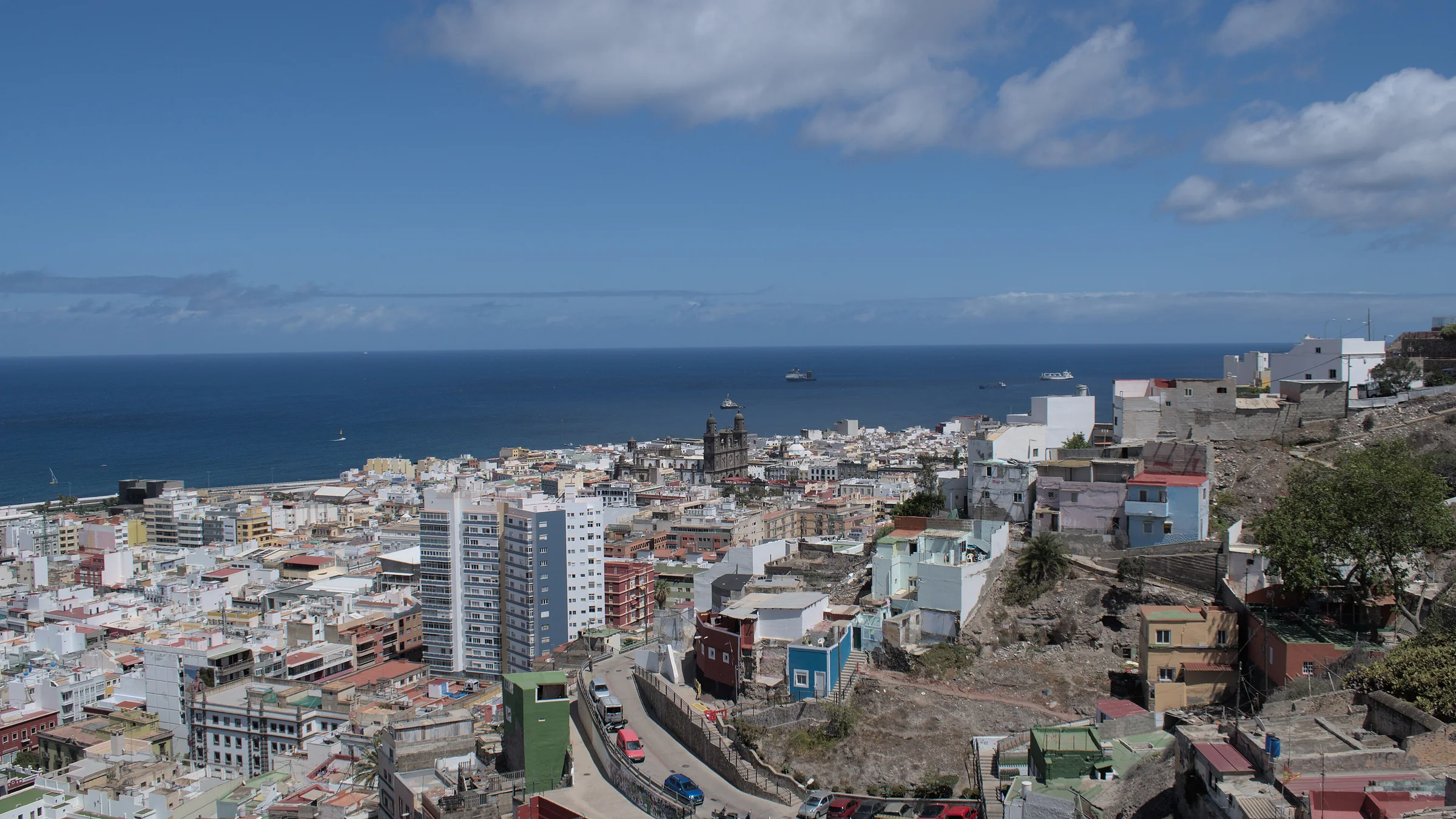
Las Palmas de Gran Canaria is a Spanish municipality in the northeast of the island of Gran Canaria. It is one of the two capitals of the autonomous community of the Canary Islands, sharing the role with Santa Cruz de Tenerife. The municipality covers 100.55 km² and had 378,675 inhabitants in 2021, a population density of about 3,766 inhabitants per km².
English rendering of the Portuguese Wikipedia summary linked below. Source: wikipedia_pt. Wikipedia revision 73047341 (2026-09-24T23:08:46Z).
Taxation
ITP (Transmisiones Patrimoniales Onerosas, property transfer tax); no official local rate collected yet (we do not invent the figure). The Canary Islands' table still to be checked at the official source.
IBI (Impuesto sobre Bienes Inmuebles, property tax): 0.62% (general rate for urban property) on the cadastral value. Base: cadastral value (latest cadastral revaluation: 1996). General rate; the municipality may apply differentiated rates to higher-value non-residential uses. Legal range of the general rate: 0.4%–1.1% (TRLRHL art. 72). Ministerio de Hacienda — Tipos impositivos IBI/IAE 2025, municípios capitais de província (quadro 1.C)
Frequently asked questions
What is the Onde Viver Bem score for Las Palmas de Gran Canaria?
Las Palmas de Gran Canaria has an indicative score of 8.57/10 in the World ranking, updated November 18, 2026. Cost of living is not part of the score.
What are the strengths and weaknesses of the score for Las Palmas de Gran Canaria?
The strongest published variables are Mild climate (10.00), Beach / mountains (10.00) and Entertainment (9.64); the weakest are Water (6.77), Bars (6.78) and Restaurants (7.70).
Does cost of living or the land price per m² enter the score?
No. Cost of living and the land price per m² appear on the page but are not part of the score. See the methodology.
How is the score calculated?
It is an indicative 0–10 quality-of-life index, with 13 variables and published weights. Safety has a 15% weight and, when local data exist, a lethal-violence penalty may cap the total. The full method is on the methodology page.
Are any figures on this page estimates?
This page has no value marked as an estimate. Each metric cites its source.
Download the image and post it to your feed, story or video. To send people to the site, use the link sticker in your story or the link in your bio (links in captions are not clickable).
Informational content and indicative scores. This is not advice on investing, immigration, buying property or choosing a career. Every metric cites its source; cost of living is not part of the score.