Updated November 18, 2026. Indicative score. Weights: entertainment 11.73% (destinations and venues, rings up to 100 km); bars 3.73%; safety 15% with a penalty; water at country level; land price per m² = official source (ITBI, Terracap, registries, valuations) or listings with a caveat · coverage 100%
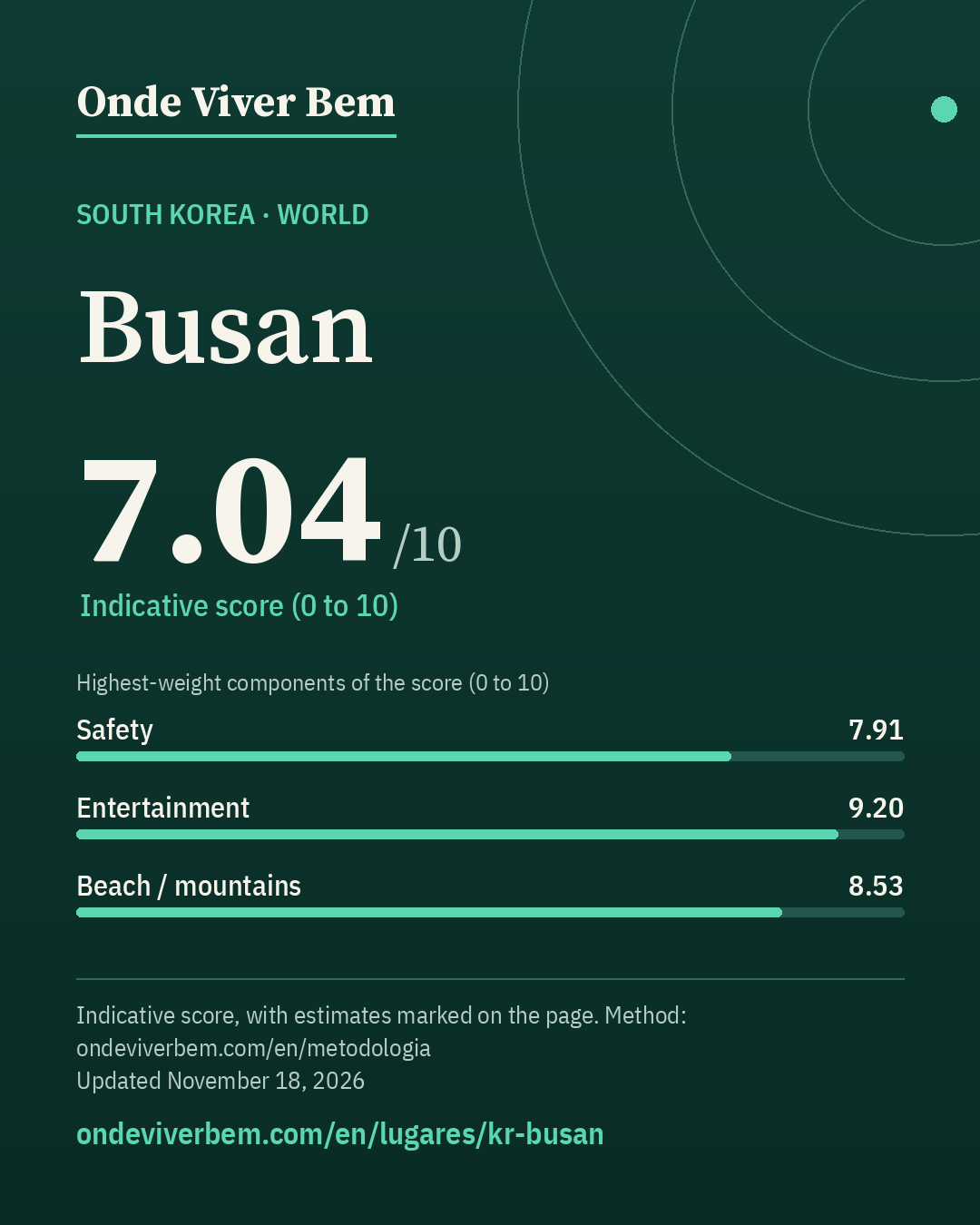
Busan has an indicative score of 7.04/10 in the World ranking of Onde Viver Bem, updated November 18, 2026. The strongest published variables are Airport (10.00), Health (9.54) and Entertainment (9.20); the weakest are Bars (3.04), Mild climate (4.67) and Sun (4.91). The scores are indicative. Cost of living is not part of the score. The published land price per m² is US$ 1,512/m² (estimated); that price is not part of the score. Some figures on this page are estimates and carry the “estimated” badge.
safety: incomplete definition (follows Seoul: WHO undetermined-intent ratio of 7.92 not applied); safety: feeling of safety at national level only (Gallup); safety: homicide and robbery unofficial (knsi.kr aggregator citing KOSIS e-지방지표; primary file not downloaded after 3 attempts); population: 2025 resident registration via the knsi.kr aggregator (unofficial; primary KOSIS file not downloaded after 3 attempts); low confidence: restaurants and bars within 2 km of the central point (Wikidata coordinate, next to City Hall in Yeonsan-dong, ~3 km from Seomyeon) — OSM and Overture count little in that radius; estimated: land price per m² (apartment × Seoul ratio; n=1, no range); estimated: PM2.5 (2024 CAMS model at the central point — the latest official measurement, from 2019, is more than 5 years old); airport: military airfield without scheduled commercial flights does not count (CHF)
unofficial Land Index (MOLIT) 2026 — median of standard points in Busan divided by 0.655 (official market realization) · source
Collected November 14, 2026 · exchange rate KRW 1346.79 per US$ (Frankfurter API (ECB reference rates), 2026-11-09)
Note: ESTIMATE: 2026 median of all land uses (₩ 1334000/m², n=20424) divided by the official 65.5% market-realization rate set by MOLIT for 2026. Not yet the residential-only median. Not a transaction.
Score breakdown
Each criterion's score, its weight in the total and the raw figure, linked to its source.
raw: 0.5553 0–10 index (40% lethal, 30% robbery, 30% perceived safety) · 40% violent deaths (log 30→0, 0.5→10 per 100k) + 30% city robbery ÷ country average (log 5×→0, 0.5×→10) + 30% share who feel safe at night (lin 30%→0, 95%→10); any part without data: weights renormalized
Composite safety: violent deaths 0.6 per 100k → 9.7 (weight 40%) · robbery 1.35× the country average (Busan Metropolitan City vs Korea (same convention as Seoul), 2024) → 5.7 (weight 30%) · 80.0% feel safe walking alone at night (South Korea (national), 2024) → 7.7 (weight 30%).
Technical note (Korea): the violent-death rate does not add undetermined-intent deaths. In South Korea the WHO undetermined÷assault ratio (2021–2023) is 7.92, far above other countries (the category is not comparable: it includes cases that elsewhere would be suicide or accident). Applied to the police figure (0.56/100k), the rate would reach 4.95/100k, implausible for Busan. Sensitivity: with the ratio, safety 5.77 (without: 7.91) and total score 6.67 (without: 7.00).
raw: 15.0 km · beach: log distance 5 km→10, 150 km→0, searched up to 100 km since 2026-11-12 (before, up to 60 km); mountains: richness of nature leisure (mean of the top 3 of 4 counts, 50 km) × access (1 up to 15 km → 0 at 150 km, log), 0 without relief; score = min(10, max(beach, mountain) + 0.3·min)
100 km radius (2026-11-12): beach within 15 km → beach 6.77; mountains 5.88; score 8.53 (before 8.53).
raw: 49.0 count of OSM objects · 50% log1p(count within 2 km), 60→10 + 50% log1p(per 10k pop.), 15→10 · since 2026-11-12: 60% this local score + 40% a regional score up to 100 km (rings 0–30/30–60/60–100 km weighted 1/0.5/0.2; count and density per inhabitant; METODOLOGIA §25)
100 km radius (2026-11-12): 999 parks at 0–30 km, 1,043 at 30–60 km and 1,501 at 60–100 km (OSM, ohsome 2026-07-27); weighted 1/0.5/0.2 = 1,821 = 1,821; weighted population 6,402,792 (GHS-POP 2025) → 2.84 per 10k people. Regional score 7.25. Local score 6.10 (weight 60%) and regional 7.25 (weight 40%) → 6.56.
raw: Average of two mapping sources, OpenStreetMap and Overture Maps (Overture count ÷ K, K = median Overture/OSM ratio across the 39 cities: 2.57 within 2 km, 3.41 in the municipality); each source: 50% log1p(count within 2 km), 1000→10 + 50% log1p(per 10k pop.), 30→10. Brazil: 50% of that score + 50% log1p(CNPJ per 10k pop. ÷ K), 30→10 · since 2026-11-12: 60% this local score + 40% a regional score up to 100 km (rings 0–30/30–60/60–100 km weighted 1/0.5/0.2; count and density per inhabitant; METODOLOGIA §25)
100 km radius (2026-11-12): 2,339 restaurants at 0–30 km, 1,821 at 30–60 km and 1,906 at 60–100 km (OSM, ohsome 2026-07-27); weighted 1/0.5/0.2 = 3,630 × OSM completeness factor 0.96 (Overture in the municipality) = 3,503; weighted population 6,402,792 (GHS-POP 2025) → 5.47 per 10k people. Regional score 7.37. Local score 5.96 (weight 60%) and regional 7.37 (weight 40%) → 6.52.
raw: 114.5 destinations + venues weighted by distance (rings up to 100 km) · 50% log1p(weighted count), 110→10 + 50% log1p(per million people in the region, GHSL), 32.0→10; rings 0–30/30–60/60–100 km weighted 1/0.5/0.2 (since 2026-11-12; before: count within 50 km, 120→10)
100 km radius (2026-11-12): 57 destinations and venues at 0–30 km, 77 at 30–60 km and 95 at 60–100 km (OSM, ohsome 2026-07-27); weighted 1/0.5/0.2 = 114 = 114; weighted population 6,402,792 (GHS-POP 2025) → 17.88 per million people. Regional score 9.20.
raw: Average of two mapping sources, OpenStreetMap and Overture Maps (Overture count ÷ K, K = median Overture/OSM ratio across the 39 cities: 2.48 within 2 km, 3.20 in the municipality); each source: 50% log1p(count within 2 km), 500→10 + 50% log1p(per 10k pop.), 10→10. Brazil: 50% of that score + 50% log1p(CNPJ per 10k pop. ÷ K), 10→10 · since 2026-11-12: 60% this local score + 40% a regional score up to 100 km (rings 0–30/30–60/60–100 km weighted 1/0.5/0.2; count and density per inhabitant; METODOLOGIA §25)
100 km radius (2026-11-12): 135 bars at 0–30 km, 74 at 30–60 km and 95 at 60–100 km (OSM, ohsome 2026-07-27); weighted 1/0.5/0.2 = 191 × OSM completeness factor 1.24 (Overture in the municipality) = 237; weighted population 6,402,792 (GHS-POP 2025) → 0.37 per 10k people. Regional score 3.85. Local score 2.50 (weight 60%) and regional 3.85 (weight 40%) → 3.04.
raw: 84.036 years · average: life expectancy lin 70→0, 85→10; Brazil: beds/10k pop. lin 0→0, 50→10; World: OSM hospitals within 10 km log1p 50→10
Clean airestimated · score 6.14 · weight 4.14%
Estimate: ESTIMATE (model, not a station reading): the latest official PM2.5 measurement (2019, 21.02 µg/m³, who_aqdb) is more than 5 years old, so under the site's rule we use the 2024 CAMS model (Open-Meteo) at the same central point: hourly mean 16.58 µg/m³ (n=8784). Range 9.3–18.6 µg/m³ = CAMS value ÷ 1.79 and ÷ 0.89, the extremes of the CAMS÷official ratio in 7 cities with official data from 2022 or later (median 1.61×; the model tends to overestimate). No correction factor on the central value.
raw: 1.0 civil airports with an IATA code within 50 km · 0 airports → 0; 1 → 7; 2 or more → 10, with an airport at 50–100 km counting 1 → 0.25 (linear) since 2026-11-12
Only civil (or joint-use) airports with an IATA code within 50 km count: PUS. Not counted: Base aérea de Jinhae (CHF), military airfields without scheduled commercial flights. Sources: OpenStreetMap (Overpass) and OurAirports (scheduled service), 2026-11-11. 100 km radius (2026-11-12): 1 within 50 km + with scheduled flights at 50–100 km: USN 52 km (weight 0.96); TAE 88 km (weight 0.43); HIN 92 km (weight 0.37); KPO 95 km (weight 0.32) → 3.09 equivalent airport(s), score 10.00.
raw: 54.0 count of OSM objects · log1p(count), 150→10 · since 2026-11-12: 60% this local score + 40% a regional score up to 100 km (rings 0–30/30–60/60–100 km weighted 1/0.5/0.2; count and density per inhabitant; METODOLOGIA §25)
100 km radius (2026-11-12): 220 cultural venues at 0–30 km, 109 at 30–60 km and 252 at 60–100 km (OSM, ohsome 2026-07-27); weighted 1/0.5/0.2 = 325 = 325; weighted population 6,402,792 (GHS-POP 2025) → 5.07 per 100k people. Regional score 8.73. Local score 7.99 (weight 60%) and regional 8.73 (weight 40%) → 8.28.
The city
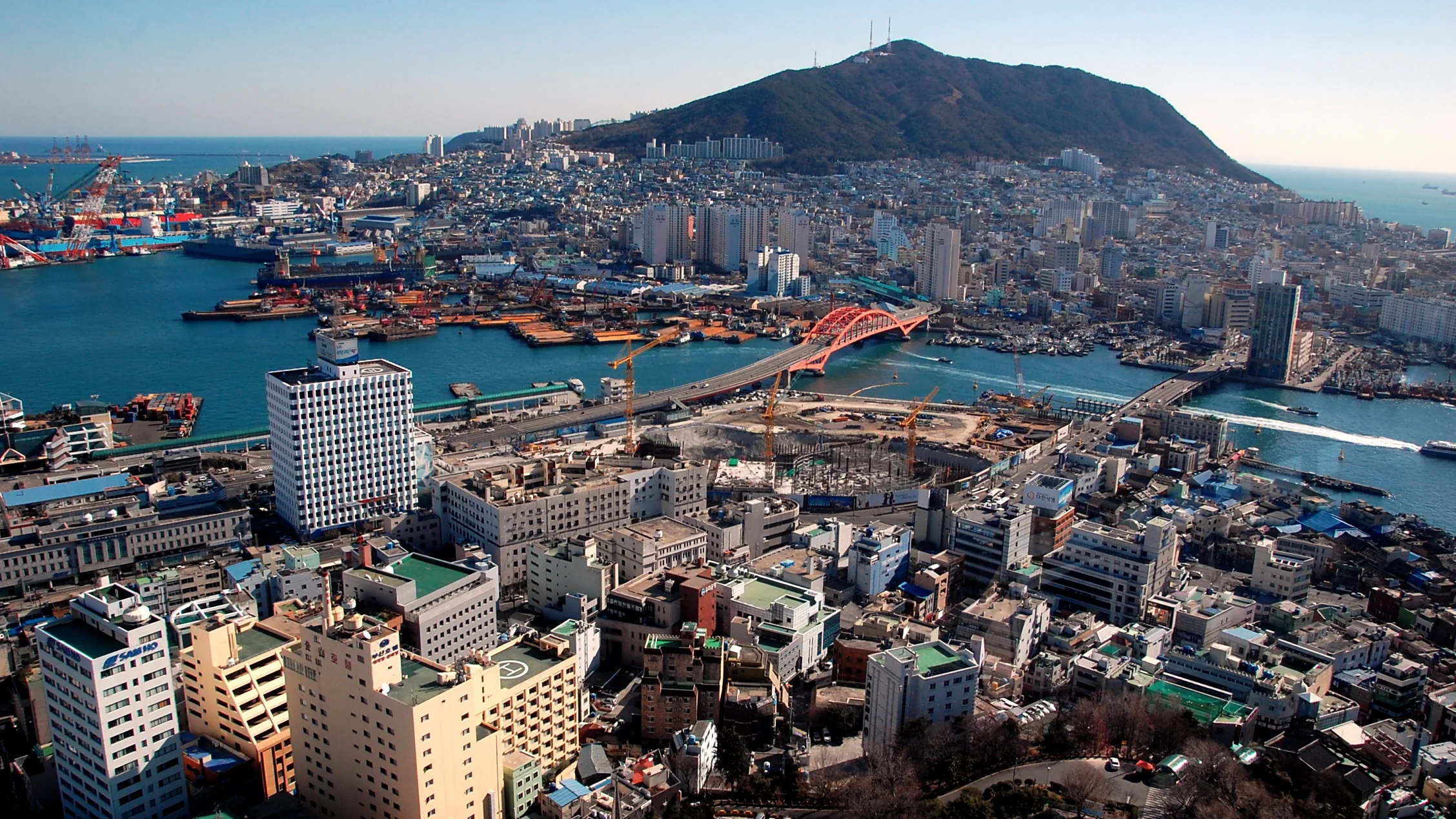
Busan, formerly known as Pusan and now officially Busan Metropolitan City, is the second most populous city in South Korea, with a population of more than 3.5 million. Its area is 770.04 km². It is the economic, cultural and educational centre of south-eastern Korea, and its port is the busiest in the country and the eighth busiest in the world, only 190 km from the Japanese islands of Kyushu and Honshu. The area around the "Southeastern Economic Zone" is South Korea's largest industrial area.
English rendering of the Portuguese Wikipedia summary linked below. Source: wikipedia_pt. Wikipedia revision 69470657 (2025-01-30T22:36:15Z).
Taxation
transfer / property tax; no official local rate collected yet (we do not invent the figure). Tax table for South Korea / Busan to be checked against the official source.
Frequently asked questions
What is the Onde Viver Bem score for Busan?
Busan has an indicative score of 7.04/10 in the World ranking, updated November 18, 2026. Cost of living is not part of the score.
What are the strengths and weaknesses of the score for Busan?
The strongest published variables are Airport (10.00), Health (9.54) and Entertainment (9.20); the weakest are Bars (3.04), Mild climate (4.67) and Sun (4.91).
Does cost of living or the land price per m² enter the score?
No. Cost of living and the land price per m² appear on the page but are not part of the score. See the methodology.
How is the score calculated?
It is an indicative 0–10 quality-of-life index, with 13 variables and published weights. Safety has a 15% weight and, when local data exist, a lethal-violence penalty may cap the total. The full method is on the methodology page.
Are any figures on this page estimates?
Yes. Some values are documented estimates, labelled with the “estimated” badge in the technical notes. The method is explained in the Estimates section.
Download the image and post it to your feed, story or video. To send people to the site, use the link sticker in your story or the link in your bio (links in captions are not clickable).
Informational content and indicative scores. This is not advice on investing, immigration, buying property or choosing a career. Every metric cites its source; cost of living is not part of the score.