Updated November 18, 2026. Indicative score. Weights: entertainment 11.73% (destinations and venues, rings up to 100 km); bars 3.73%; safety 15% with a penalty; water at country level; land price per m² = official source (ITBI, Terracap, registries, valuations) or listings with a caveat · coverage 100%
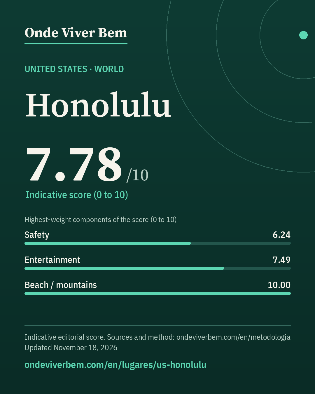
Honolulu has an indicative score of 7.78/10 in the World ranking of Onde Viver Bem, updated November 18, 2026. The strongest published variables are Clean air (10.00), Mild climate (10.00) and Beach / mountains (10.00); the weakest are Bars (4.12), Health (5.61) and Safety (6.24). The scores are indicative. Cost of living is not part of the score. The published land price per m² is US$ 1,040/m² (estimated); that price is not part of the score. Some figures on this page are estimates and carry the “estimated” badge.
safety: safety perception only at national level (Gallup, 2024 survey, 2025 report); profile population 988,703 (QuickFacts 2025); HPD 2024 rate denominator = 998,747; estimated: land price per m² (FHFA Land 2022 × HPI)
Land price per m²
US$ 1,040/m²estimated – low confidenceestimated · sensitivity range US$ 876–US$ 1,579 · n=9 · small sample
unofficial ESTIMATE: FHFA Land 2022 × metro HPI to 2026Q2 — standardized residential lot (1/4 acre) (low confidence) · source
Note: ESTIMATE (low confidence): FHFA Land 2022 value (US$ 896.00/m², n=9 ZIPs, standardized 1/4-acre lot) × All-Transactions HPI for the Urban Honolulu, HI metro (2026Q2 ÷ 2022Q1–Q4 average = 1.1610). Small sample: 9 Oahu ZIPs with a value (almost the whole urban universe). The ZIP P25–P75 band is a sensitivity range, not a confidence interval. The FHFA land series ends in 2022.
Score breakdown
Each criterion's score, its weight in the total and the raw figure, linked to its source.
raw: 3.91 per 100k pop. · 40% violent deaths (log 30→0, 0.5→10 per 100k) + 30% city robbery ÷ country average (log 5×→0, 0.5×→10) + 30% share who feel safe at night (lin 30%→0, 95%→10); any part without data: weights renormalized
Composite safety: violent deaths 3.9 per 100k → 5.0 (weight 40%) · robbery 0.82× the country average (city / City and County, local 2024 vs EUA 2024) → 7.9 (weight 30%) · 71.0% feel safe walking alone at night (United States (national), 2024) → 6.3 (weight 30%).
raw: 5.0 km · beach: log distance 5 km→10, 150 km→0, searched up to 100 km since 2026-11-12 (before, up to 60 km); mountains: richness of nature leisure (mean of the top 3 of 4 counts, 50 km) × access (1 up to 15 km → 0 at 150 km, log), 0 without relief; score = min(10, max(beach, mountain) + 0.3·min)
100 km radius (2026-11-12): beach within 5 km → beach 10.00; mountains 9.83; score 10.00 (before 10.00).
raw: 41.0 count of OSM objects · 50% log1p(count within 2 km), 60→10 + 50% log1p(per 10k pop.), 15→10 · since 2026-11-12: 60% this local score + 40% a regional score up to 100 km (rings 0–30/30–60/60–100 km weighted 1/0.5/0.2; count and density per inhabitant; METODOLOGIA §25)
100 km radius (2026-11-12): 330 parks at 0–30 km, 35 at 30–60 km and 3 at 60–100 km (OSM, ohsome 2026-07-27); weighted 1/0.5/0.2 = 348 = 348; weighted population 1,024,219 (GHS-POP 2025) → 3.40 per 10k people. Regional score 6.56. Local score 7.33 (weight 60%) and regional 6.56 (weight 40%) → 7.02.
raw: 147.0 count of OSM objects · Average of two mapping sources, OpenStreetMap and Overture Maps (Overture count ÷ K, K = median Overture/OSM ratio across the 39 cities: 2.57 within 2 km, 3.41 in the municipality); each source: 50% log1p(count within 2 km), 1000→10 + 50% log1p(per 10k pop.), 30→10. Brazil: 50% of that score + 50% log1p(CNPJ per 10k pop. ÷ K), 30→10 · since 2026-11-12: 60% this local score + 40% a regional score up to 100 km (rings 0–30/30–60/60–100 km weighted 1/0.5/0.2; count and density per inhabitant; METODOLOGIA §25)
100 km radius (2026-11-12): 790 restaurants at 0–30 km, 94 at 30–60 km and 1 at 60–100 km (OSM, ohsome 2026-07-27); weighted 1/0.5/0.2 = 837 × OSM completeness factor 1.00 (Overture in the municipality) = 842; weighted population 1,024,219 (GHS-POP 2025) → 8.22 per 10k people. Regional score 7.15. Local score 7.16 (weight 60%) and regional 7.15 (weight 40%) → 7.16.
raw: 19.5 destinations + venues weighted by distance (rings up to 100 km) · 50% log1p(weighted count), 110→10 + 50% log1p(per million people in the region, GHSL), 32.0→10; rings 0–30/30–60/60–100 km weighted 1/0.5/0.2 (since 2026-11-12; before: count within 50 km, 120→10)
100 km radius (2026-11-12): 19 destinations and venues at 0–30 km, 1 at 30–60 km and 0 at 60–100 km (OSM, ohsome 2026-07-27); weighted 1/0.5/0.2 = 20 = 20; weighted population 1,024,219 (GHS-POP 2025) → 19.04 per million people. Regional score 7.49.
raw: 19.0 count of OSM objects · Average of two mapping sources, OpenStreetMap and Overture Maps (Overture count ÷ K, K = median Overture/OSM ratio across the 39 cities: 2.48 within 2 km, 3.20 in the municipality); each source: 50% log1p(count within 2 km), 500→10 + 50% log1p(per 10k pop.), 10→10. Brazil: 50% of that score + 50% log1p(CNPJ per 10k pop. ÷ K), 10→10 · since 2026-11-12: 60% this local score + 40% a regional score up to 100 km (rings 0–30/30–60/60–100 km weighted 1/0.5/0.2; count and density per inhabitant; METODOLOGIA §25)
100 km radius (2026-11-12): 82 bars at 0–30 km, 3 at 30–60 km and 3 at 60–100 km (OSM, ohsome 2026-07-27); weighted 1/0.5/0.2 = 84 × OSM completeness factor 1.18 (Overture in the municipality) = 100; weighted population 1,024,219 (GHS-POP 2025) → 0.97 per 10k people. Regional score 4.05. Local score 4.17 (weight 60%) and regional 4.05 (weight 40%) → 4.12.
raw: 1.0 civil IATA airports with scheduled service (B12, 50 km) · 0 airports → 0; 1 → 7; 2 or more → 10, with an airport at 50–100 km counting 1 → 0.25 (linear) since 2026-11-12
100 km radius (2026-11-12): 1 within 50 km + with scheduled flights at 50–100 km: MKK 81 km (weight 0.54) → 1.54 equivalent airport(s), score 8.62.
raw: 34.0 count of OSM objects · log1p(count), 150→10 · since 2026-11-12: 60% this local score + 40% a regional score up to 100 km (rings 0–30/30–60/60–100 km weighted 1/0.5/0.2; count and density per inhabitant; METODOLOGIA §25)
100 km radius (2026-11-12): 59 cultural venues at 0–30 km, 10 at 30–60 km and 2 at 60–100 km (OSM, ohsome 2026-07-27); weighted 1/0.5/0.2 = 64 = 64; weighted population 1,024,219 (GHS-POP 2025) → 6.29 per 100k people. Regional score 7.76. Local score 7.09 (weight 60%) and regional 7.76 (weight 40%) → 7.36.
The city
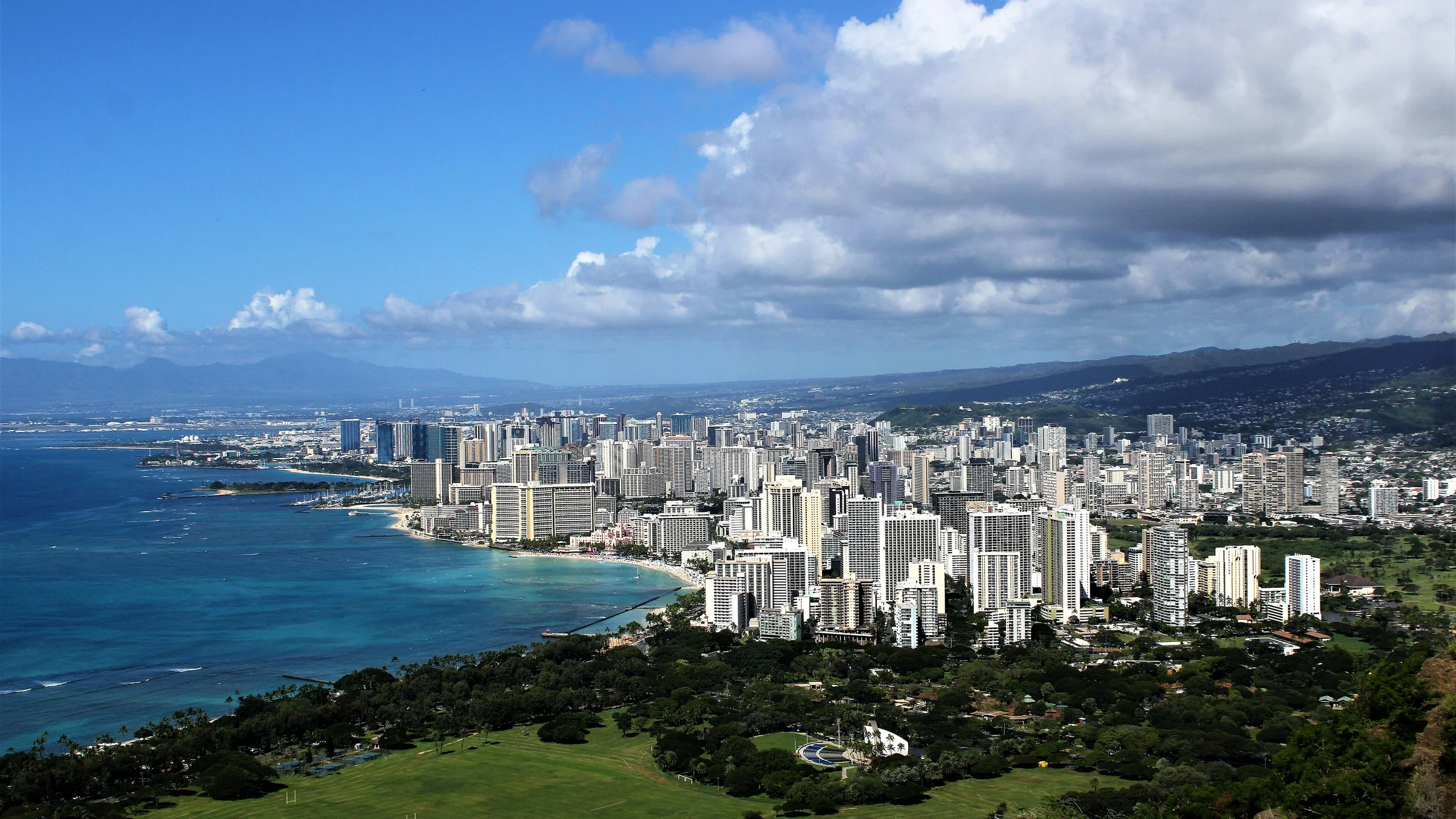
Honolulu is the capital and most populous city of the U.S. state of Hawaii, coinciding in area with Honolulu County and occupying the entire island of Oahu. It was founded in 1845 and incorporated on 30 April 1907. It is also the birthplace of the 44th President of the United States, Barack Obama.
English rendering of the Portuguese Wikipedia summary linked below. Source: wikipedia_pt. Wikipedia revision 71066645 (2025-10-22T06:12:11Z).
Honolulu has an indicative score of 7.78/10 in the World ranking, updated November 18, 2026. Cost of living is not part of the score.
What are the strengths and weaknesses of the score for Honolulu?
The strongest published variables are Clean air (10.00), Mild climate (10.00) and Beach / mountains (10.00); the weakest are Bars (4.12), Health (5.61) and Safety (6.24).
Does cost of living or the land price per m² enter the score?
No. Cost of living and the land price per m² appear on the page but are not part of the score. See the methodology.
How is the score calculated?
It is an indicative 0–10 quality-of-life index, with 13 variables and published weights. Safety has a 15% weight and, when local data exist, a lethal-violence penalty may cap the total. The full method is on the methodology page.
Are any figures on this page estimates?
Yes. Some values are documented estimates, labelled with the “estimated” badge in the technical notes. The method is explained in the Estimates section.
Download the image and post it to your feed, story or video. To send people to the site, use the link sticker in your story or the link in your bio (links in captions are not clickable).
Informational content and indicative scores. This is not advice on investing, immigration, buying property or choosing a career. Every metric cites its source; cost of living is not part of the score.