Updated November 18, 2026. Indicative score. Weights: entertainment 11.73% (destinations and venues, rings up to 100 km); bars 3.73%; safety 15% with a penalty; water at country level; land price per m² = official source (ITBI, Terracap, registries, valuations) or listings with a caveat · coverage 100%
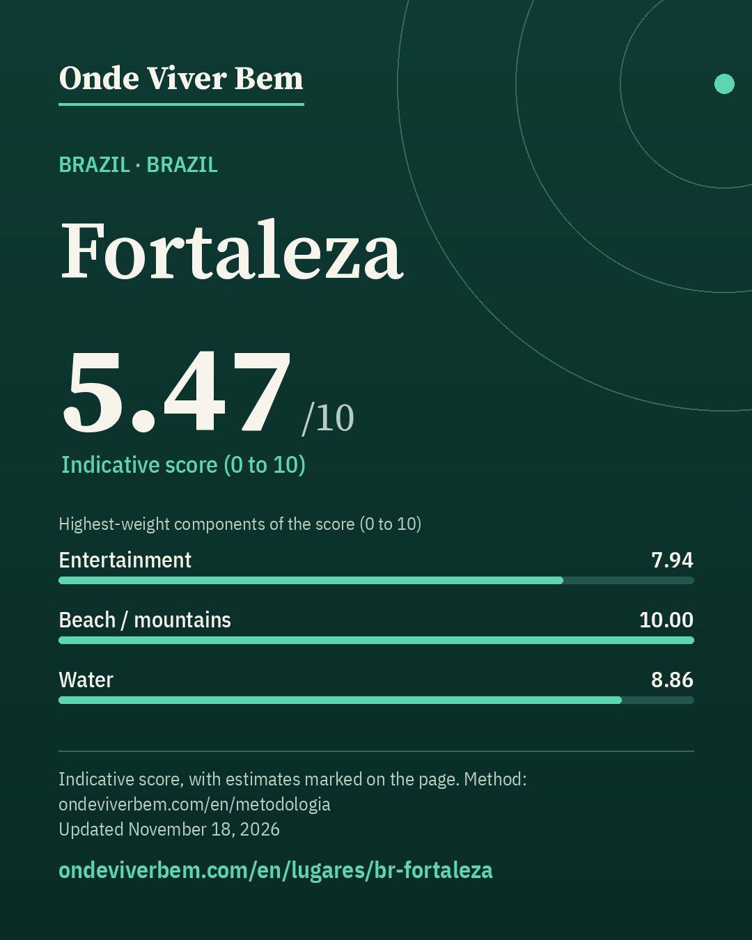
Fortaleza has an indicative score of 5.47/10 in the Brazil ranking of Onde Viver Bem, updated November 18, 2026. The strongest published variables are Beach / mountains (10.00), Sun (10.00) and Clean air (9.69); the weakest are Safety (1.99), Bars (3.84) and Restaurants (5.27). The scores are indicative. Cost of living is not part of the score. The published land price per m² is R$ 744/m² (listing); that price is not part of the score. Some figures on this page are estimates and carry the “estimated” badge.
safety: feeling of safety at national level only (Gallup); estimated: air (PM2.5 without a station in the WHO database); estimated: robbery (official state total × the capital's official share in Jan–Apr 2025 and 2026); safety penalty: score capped at 5.47 (rate 57.6/100k; 6.91 without the penalty)
Land price per m²
R$ 744/m²listingP25–P75 R$ 484–R$ 1,122 · n=147
unofficial plot listings (asking price) — no open ITBI data; listings with a caveat
Note: Asking price in a listing (not a transaction), ZAP Imóveis, 2026-11-11. Check: median of the medians of 14 neighbourhoods with 3+ listings = R$ 703.54/m² (n=147 in 55 neighbourhoods).
Spread by neighbourhood (sample)
Neighbourhood
n
Median
P25–P75
Lagoa Redonda
18
R$ 480
R$ 326–R$ 632
Edson Queiroz
13
R$ 690
R$ 328–R$ 833
Sapiranga-Coité
12
R$ 703
R$ 539–R$ 793
Sabiaguaba
10
R$ 802
R$ 300–R$ 1,274
José de Alencar
5
R$ 600
R$ 434–R$ 731
Mondubim
5
R$ 704
R$ 606–R$ 765
Parque Dois Irmãos
5
R$ 1,309
R$ 1,300–R$ 1,488
Prefeito José Walter
5
R$ 550
R$ 528–R$ 552
Centro
4
R$ 1,535
R$ 904–R$ 1,914
Engenheiro Luciano Cavalcante
4
R$ 1,096
R$ 974–R$ 1,204
Manuel Dias Branco
4
R$ 1,074
R$ 919–R$ 1,211
Planalto Ayrton Senna
4
R$ 550
R$ 480–R$ 752
Aracapé
3
R$ 673
R$ 657–R$ 791
Parque Manibura
3
R$ 1,070
R$ 1,027–R$ 1,397
—
2
R$ 813
R$ 700–R$ 926
Score breakdown
Each criterion's score, its weight in the total and the raw figure, linked to its source.
Safetyestimated · score 1.99 · weight 15.00%
Estimate: ESTIMATE (not a measurement): Ceará did not publish Fortaleza's 2024 vehicle robbery in a file reachable by our collector (ce.gov.br portals blocked for the server). State total in 2024: 6,588 vehicle robberies (Supesp, same as SINESP VDE). Fortaleza's share: 56.4% (1,037 of 1,840 from January to April 2025, Supesp bulletin). 6,588 × 0.564 ≈ 3,713 robberies ÷ 2,574,412 inhabitants (IBGE 2024) = 144.2 per 100,000, against 59.4 in Brazil = 2.43×. Range from 1.91× with the January–April 2026 share (331 of 747 = 44.3%). Assumes the 2025 share holds for 2024.
raw: 57.64 per 100k pop. · 40% violent deaths (log 30→0, 0.5→10 per 100k) + 30% city robbery ÷ country average (log 5×→0, 0.5×→10) + 30% share who feel safe at night (lin 30%→0, 95%→10); any part without data: weights renormalized
Composite safety: violent deaths 57.6 per 100k → 0.0 (weight 40%) · ESTIMATED robbery 2.28× the country average (official regional figure; range 1.91–2.43×) → 3.4 (weight 30%) estimated · 51.0% feel safe walking alone at night (Brazil (national), 2024) → 3.2 (weight 30%).
raw: 5.0 km · beach: log distance 5 km→10, 150 km→0, searched up to 100 km since 2026-11-12 (before, up to 60 km); mountains: richness of nature leisure (mean of the top 3 of 4 counts, 50 km) × access (1 up to 15 km → 0 at 150 km, log), 0 without relief; score = min(10, max(beach, mountain) + 0.3·min)
100 km radius (2026-11-12): beach within 5 km → beach 10.00; mountains 3.62; score 10.00 (before 10.00).
raw: 35.0 count of OSM objects · 50% log1p(count within 2 km), 60→10 + 50% log1p(per 10k pop.), 15→10 · since 2026-11-12: 60% this local score + 40% a regional score up to 100 km (rings 0–30/30–60/60–100 km weighted 1/0.5/0.2; count and density per inhabitant; METODOLOGIA §25)
100 km radius (2026-11-12): 850 parks at 0–30 km, 156 at 30–60 km and 152 at 60–100 km (OSM, ohsome 2026-07-27); weighted 1/0.5/0.2 = 958 = 958; weighted population 4,015,312 (GHS-POP 2025) → 2.39 per 10k people. Regional score 6.60. Local score 6.65 (weight 60%) and regional 6.60 (weight 40%) → 6.63.
raw: 6206.0 active businesses (CNPJ) · Average of two mapping sources, OpenStreetMap and Overture Maps (Overture count ÷ K, K = median Overture/OSM ratio across the 39 cities: 2.57 within 2 km, 3.41 in the municipality); each source: 50% log1p(count within 2 km), 1000→10 + 50% log1p(per 10k pop.), 30→10. Brazil: 50% of that score + 50% log1p(CNPJ per 10k pop. ÷ K), 30→10 · since 2026-11-12: 60% this local score + 40% a regional score up to 100 km (rings 0–30/30–60/60–100 km weighted 1/0.5/0.2; count and density per inhabitant; METODOLOGIA §25)
100 km radius (2026-11-12): 871 restaurants at 0–30 km, 52 at 30–60 km and 136 at 60–100 km (OSM, ohsome 2026-07-27); weighted 1/0.5/0.2 = 924 × OSM completeness factor 1.20 (Overture in the municipality) = 1,104; weighted population 4,015,312 (GHS-POP 2025) → 2.75 per 10k people. Regional score 5.88. Local score 4.86 (weight 60%) and regional 5.88 (weight 40%) → 5.27.
raw: 51.0 destinations + venues weighted by distance (rings up to 100 km) · 50% log1p(weighted count), 110→10 + 50% log1p(per million people in the region, GHSL), 32.0→10; rings 0–30/30–60/60–100 km weighted 1/0.5/0.2 (since 2026-11-12; before: count within 50 km, 120→10)
100 km radius (2026-11-12): 43 destinations and venues at 0–30 km, 10 at 30–60 km and 15 at 60–100 km (OSM, ohsome 2026-07-27); weighted 1/0.5/0.2 = 51 = 51; weighted population 4,015,312 (GHS-POP 2025) → 12.70 per million people. Regional score 7.94.
raw: 1181.0 active businesses (CNPJ) · Average of two mapping sources, OpenStreetMap and Overture Maps (Overture count ÷ K, K = median Overture/OSM ratio across the 39 cities: 2.48 within 2 km, 3.20 in the municipality); each source: 50% log1p(count within 2 km), 500→10 + 50% log1p(per 10k pop.), 10→10. Brazil: 50% of that score + 50% log1p(CNPJ per 10k pop. ÷ K), 10→10 · since 2026-11-12: 60% this local score + 40% a regional score up to 100 km (rings 0–30/30–60/60–100 km weighted 1/0.5/0.2; count and density per inhabitant; METODOLOGIA §25)
100 km radius (2026-11-12): 227 bars at 0–30 km, 14 at 30–60 km and 49 at 60–100 km (OSM, ohsome 2026-07-27); weighted 1/0.5/0.2 = 244 × OSM completeness factor 1.45 (Overture in the municipality) = 353; weighted population 4,015,312 (GHS-POP 2025) → 0.88 per 10k people. Regional score 4.70. Local score 3.27 (weight 60%) and regional 4.70 (weight 40%) → 3.84.
raw: 76.023 years · average: life expectancy lin 70→0, 85→10; Brazil: beds/10k pop. lin 0→0, 50→10; World: OSM hospitals within 10 km log1p 50→10
Clean airestimated · score 9.69 · weight 4.14%
Estimate: ESTIMATE (not a measurement): the city has no station in the WHO air quality database. Brazil's national average (World Bank, 2023: 13.38 µg/m³) × the city÷Brazil ratio of satellite-derived PM2.5 in the municipality (AQLI/University of Chicago, ACAG/Washington University in St. Louis data, 2023: 5.37 in the city ÷ 12.14 in Brazil, population-weighted = 0.442) = 5.9 µg/m³. Range 5.2–6.0 = same calculation with each year's ratio from 2019 to 2023 (floor and ceiling at one decimal place, so it contains the point). AQLI's satellite series excludes mineral dust and sea salt, so we only use the city-to-country ratio, not the absolute value. Here 2023, the latest year in the series (the same year used for the other Brazilian cities without a station), is also the highest value of 2019–2023, so the point sits at the top of the range.
PM2.5 = mean of the 2021–2024 annual means (2023: 11.3; 2024: 10.2 µg/m³) = 10.7 µg/m³; lowest and highest year 10.2–11.3. Source: WHO Ambient Air Quality Database v8 (2026), available 2021–2024 annual means; station: base da OMS v8 (rede estadual). Rule (Nov 11, 2026): four-year mean, so the score does not hinge on one fire or drought year.
raw: 63.0 count of OSM objects · log1p(count), 150→10 · since 2026-11-12: 60% this local score + 40% a regional score up to 100 km (rings 0–30/30–60/60–100 km weighted 1/0.5/0.2; count and density per inhabitant; METODOLOGIA §25)
100 km radius (2026-11-12): 96 cultural venues at 0–30 km, 9 at 30–60 km and 17 at 60–100 km (OSM, ohsome 2026-07-27); weighted 1/0.5/0.2 = 104 = 104; weighted population 4,015,312 (GHS-POP 2025) → 2.59 per 100k people. Regional score 6.65. Local score 8.29 (weight 60%) and regional 6.65 (weight 40%) → 7.63.
The city
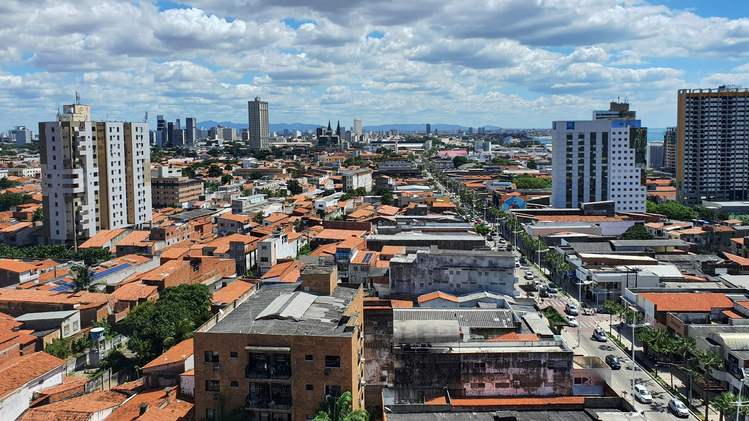
Fortaleza is the capital of the Brazilian state of Ceará, in the country's Northeast Region. Located 2,285 km from Brasília, the federal capital, the city grew up on the banks of the Pajeú stream, and its name alludes to Fort Schoonenborch, built by the Dutch during their second stay there, between 1649 and 1654, which gave rise to the municipality. Fortaleza's motto, on its coat of arms, is the Latin word Fortitudine, meaning "by/with strength, valour, courage".
English rendering of the Portuguese Wikipedia summary linked below. Source: wikipedia_pt. Wikipedia revision 73264114 (2026-10-21T19:29:23Z).
Taxation
ITBI; no official local rate collected yet (we do not invent the figure). GAP: rate found only in secondary sources (sometimes conflicting); to be confirmed in the law or on the city's page
IPTU; no official local rate collected yet (we do not invent the figure). GAP: progressive tables by assessed value/use; to be collected from municipal law
Frequently asked questions
What is the Onde Viver Bem score for Fortaleza?
Fortaleza has an indicative score of 5.47/10 in the Brazil ranking, updated November 18, 2026. Cost of living is not part of the score.
What are the strengths and weaknesses of the score for Fortaleza?
The strongest published variables are Beach / mountains (10.00), Sun (10.00) and Clean air (9.69); the weakest are Safety (1.99), Bars (3.84) and Restaurants (5.27).
Does cost of living or the land price per m² enter the score?
No. Cost of living and the land price per m² appear on the page but are not part of the score. See the methodology.
How is the score calculated?
It is an indicative 0–10 quality-of-life index, with 13 variables and published weights. Safety has a 15% weight and, when local data exist, a lethal-violence penalty may cap the total. The full method is on the methodology page.
Are any figures on this page estimates?
Yes. Some values are documented estimates, labelled with the “estimated” badge in the technical notes. The method is explained in the Estimates section.
Download the image and post it to your feed, story or video. To send people to the site, use the link sticker in your story or the link in your bio (links in captions are not clickable).
Informational content and indicative scores. This is not advice on investing, immigration, buying property or choosing a career. Every metric cites its source; cost of living is not part of the score.